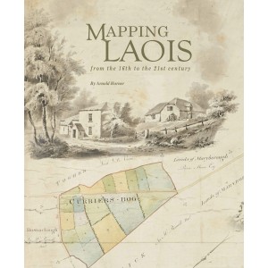
In Mapping Laois from the 16th to the 21st century, Arnold Horner reviews and seeks to provide context for the extraordinarily rich diversity of manuscript and printed maps that record the changing political, economic and social circumstances of an Irish county over nearly five centuries. The flavour of these varied, informative and often colourful maps is captured in over 400 illustrations, among which are reproductions of six early county maps and a unique assemblage of images from the Ordnance Survey ‘fair plans’ of c. 1838–40.
With a map record that stretches back more than 450 years, County Laois (formerly Leix and Laoighis, and between 1556 and 1920 officially known as Queen’s County) has a distinguished place in the history of cartography in Ireland. This book explores that record, from the first map of c. 1560, covering the eastern part of the county, through to the present century. The aim here is to draw attention to the extent, variety and interest of the maps made during a period of major transformation across the county—a period when far-reaching changes in landownership and settlement were accompanied by significant environmental modifications.
Key features:
• Comprehensively illustrated with 400 maps
• Comprehensive coverage of County Laois from the 16th century to the 21st century
Out now
Arnold Horner formerly lectured in Geography at University College Dublin. He has written widely on the geography of Ireland, giving increasing attention in recent years to the history of maps and mapping in Ireland. He has had three books published by Wordwell concerning the innovative county maps produced in the early nineteenth century by the roads engineer and surveyor William Larkin: Mapping Offaly(2006), Mapping Meath (2007) and Mapping Sligo(2011). His book exploringDocuments relating to the Bogs Commission 1809–1813was published by the Irish Manuscripts Commission in 2018.
Mapping Laois from the 16th to the 21st century
- ISBN: ISBN 978-1-999790
- Availability: 2-3 Days
-
€30.00
Related Products
Mapping South Kerry
South Kerry was always a place with its own distinctive personality, and once the heart of a great I..
€50.00
The Lead Mines
Ballycorus and Wicklow.A hilltop chimney in the foothills of the Dublin Mountains is a very prominen..
€20.00
DUBLIN'S INDUSTRIAL HERITAGE:
From Sandymount Strand to Crumlin Road.This work is the first in a three-volume series of richl..
€17.99
Tags: Cartography Ireland


